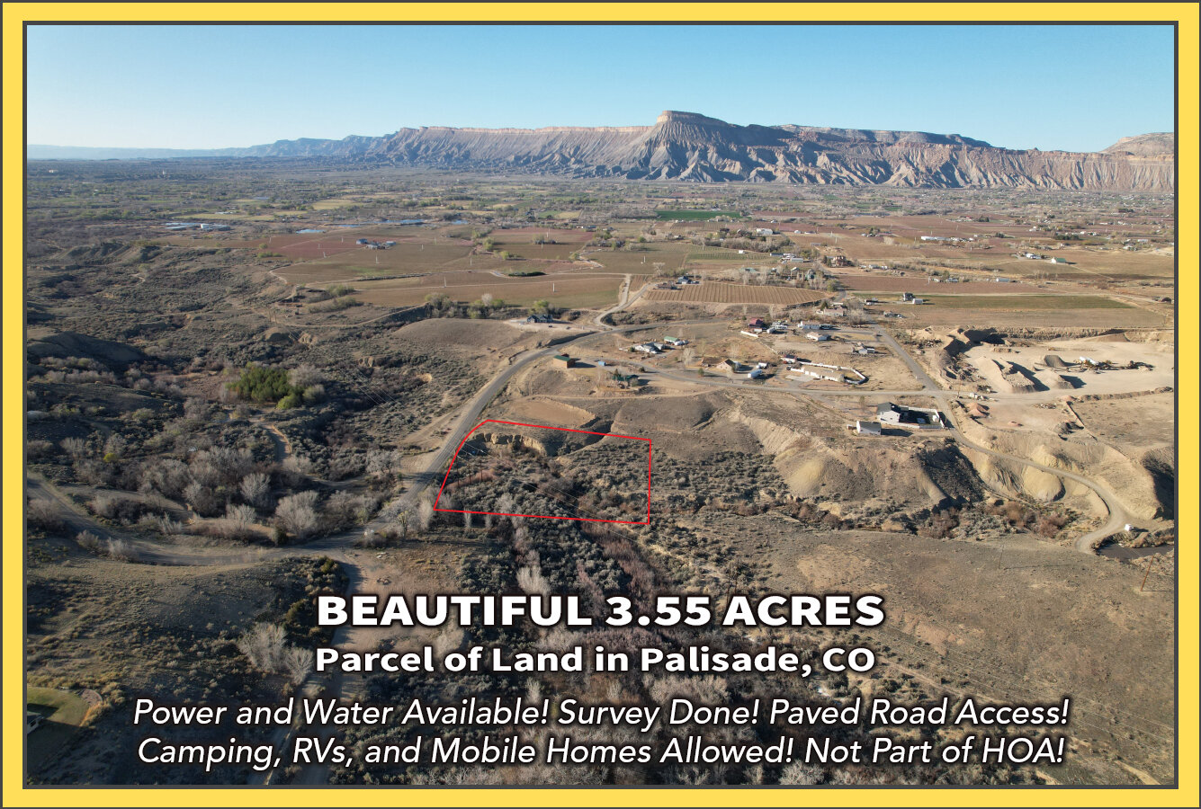
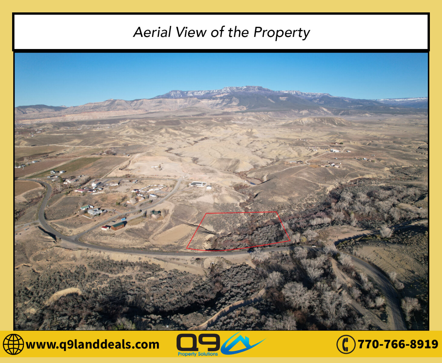
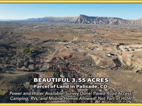
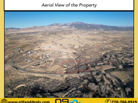
3.55-Acre Gem in Mesa County, Colorado! Power and Water Available! Paved Road Access! Survey Done! Camping, RVs, and Mobile Homes Allowed! Not Part of HOA! Owner Financing Available!
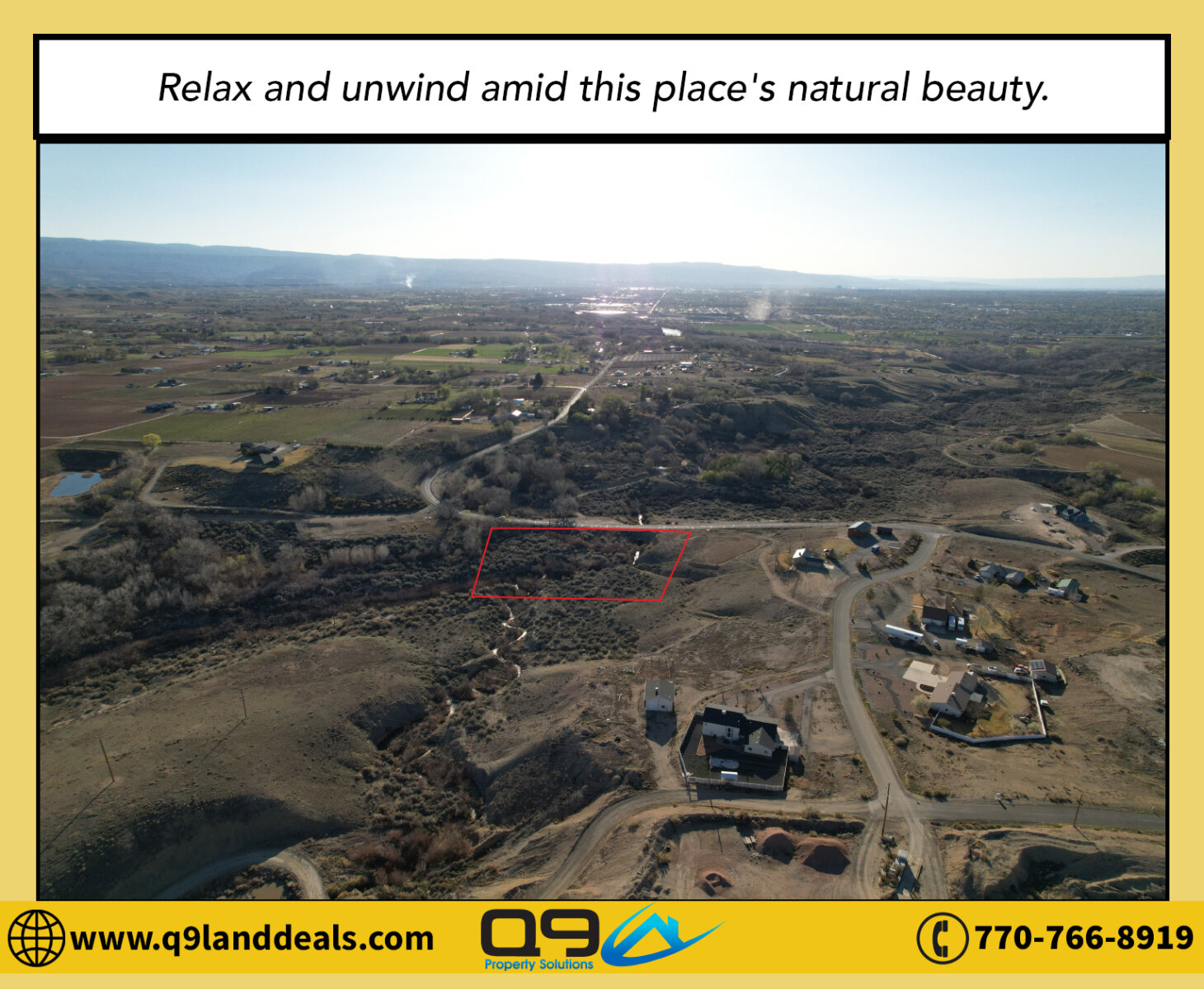
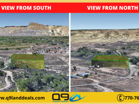
Country living has become a popular choice for those looking for a spot to vacation or for those who are simply tired of the noise and turmoil of life in the city. If you are one of those people, this pristine 3.55-Acre gem is perfect for you! Tucked in the tree lines of the breathtaking Mesa County, FL, and just about 25 minutes this lot enjoys the soothing vibe brought by the tranquil surroundings.
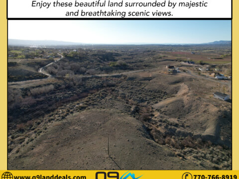
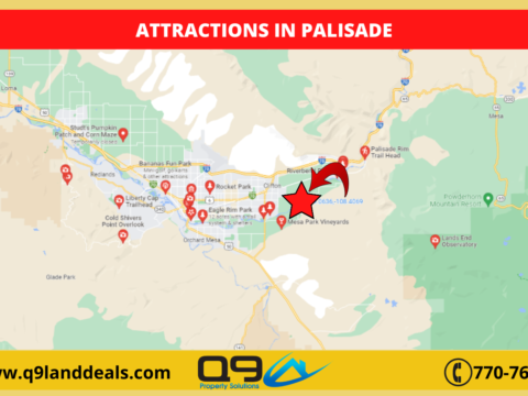
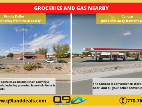
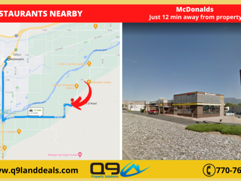
Uncover the beauty of Mesa County and check out incredible attractions and mountain ranges on the horizon. Bring yourself down to a state of calmness. Relax amidst nature and go hiking in the mountains. This property will also have you on a roller coaster of investment opportunities! The 3.55-acre rough diamond is situated outside city limits for your peace of mind which makes for fewer restrictions. And, needless to say, restocking for weekly supplies is incredibly easy!
What are you waiting for? Call us today at 770-766-8919!
Pricing Details:
Cash Price: $77,000
Property Details:
Parcel Number: R026367
County: Mesa County
City: Palisade
State: CO
Zip Code: 81526
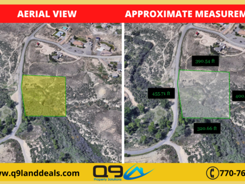
Parcel Size: 3.55 acres
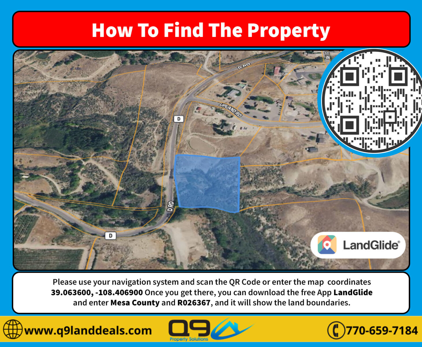
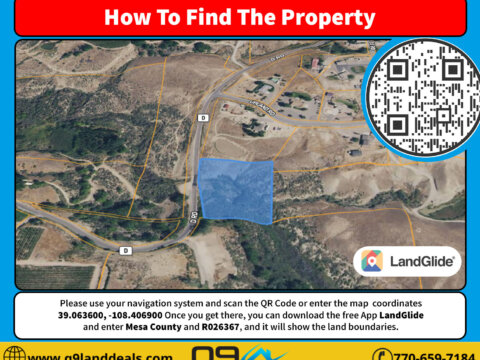
Center GPS Coordinates: 39.063600, -108.406900
Legal Description: Outlot A Upland Estates Filing No 1 Secs 17 & 18 1s 2e 3.55ac
Elevation: 4724.4 feet
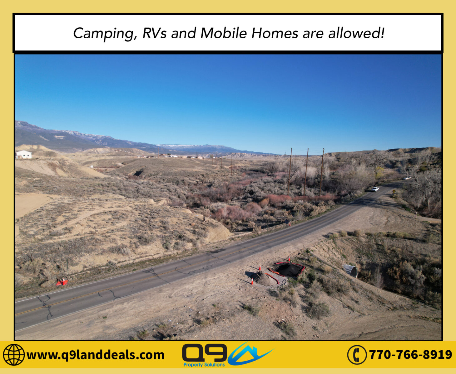
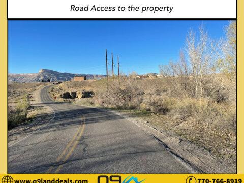
Property Access: Paved Road
Property Tax: $153.84 (2021)
What is the zoning of the property? AFT Residential
Terrain type? Slope
Property use code? None
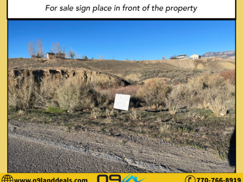
Is the land cleared? There are some woods in the property
Is the property buildable? Unbuildable Lot, As per Mrs. Faye the property is “OUTLOT” means it is not buildable and maybe for recreational use, but currently the property is in drainage use by the HO. Confirmed by Mrs. Faye the planner of the County.
What can be built on the property? Single Family Residential, for other types of homes it would need to be approved by the Building Department.
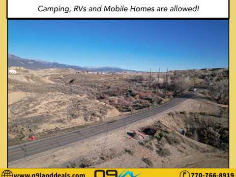
Can we camp on the property? Yes, Would need to have a conditional use permit
Are RV’s allowed on the property? Yes, Allowed within 6 months while the construction of building is in the process, but can’t live in an RV.
Are Mobile homes allowed on the property? Yes, Would need to be approved by the building department
Are tiny houses or small cabins allowed in the property? Yes/No, Would need to be approved by the building department, and would need to meet the County standard.
Is there a total size restriction for any structures on the lot? None
Are there any building height restrictions? 35 feet
What are the setbacks of the lot? 50ft front, 30ft rear, 10ft sides
What is the minimum lot size to build on the property? 1 acre
Is there any time limit to build? 6 months
Is there a County or City Impact fee required to build and if so how much does this cost? N/a
Is the property in a flood zone and if so what needs to be done to the lot in order to build? Not in a flood zone area
Any other restrictions? None
County Operator Details who Confirmed the Information: County Planner: Mrs. Faye – 970-244-1636
Does the property have water connected? Not yet connected, but water is available in the area
Company name and the phone number: Ute Water Conservancy District – 970-242-7491
Does the property currently have Sewer or septic? Would need to install a septic system
Company Name & the Contact information: Owens & Son’s Plumbing, Septic and Drains – 970-986-7426
If the septic system has to be installed, do we need to percolate the soil? Yes
Does the property currently have electricity connected? Not yet connected, but electricity is available in the area
What is the electric company name: Xcel Energy – 800-895-4999
What type of gas does this area service? Propane gas
Will the county or city pick up the trash? None, Responsibility of the owner
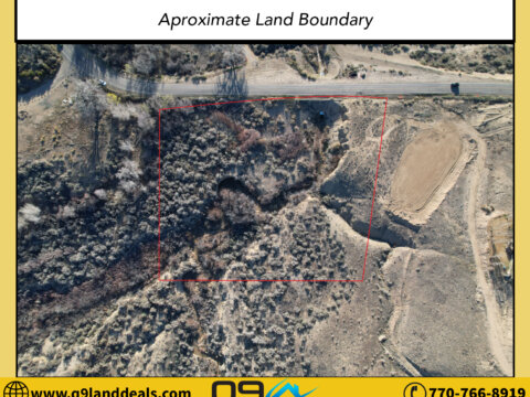
The Parcel number of the property is R026367. If you want to walk the property and see where the boundaries of the land are, you can plug the map coordinates 39.063600, -108.406900 into your phone in google maps. Or you can use a phone app called landglide and you would input the parcel number R026367 and Mesa County and it would highlight the lot on the map for you. If you have specific questions on what can be put on the lot please call the building and zoning department of Mesa County at (970) 244-1636.
Directions:
Heading west bound on I-70, follow signs for I-70 W to G Rd. in Mesa County, and take exit 44 toward US-6 W/Palisade. Continue onto G Rd. for 0.7 miles, then turn left onto 38 Rd, and continue straight onto F1/4 Rd for another 1.7 miles. Turn left onto 37 ¼ Rd, then after a quick 0.2 miles, 37 ¼ Rd turns slightly right and becomes F Rd. Continue on F Rd. for 1.2 miles, then F Rd. turns slightly left and becomes 36 Rd. for another 0.5 miles. Turn right onto E 1/2 Rd, then continue onto 35 1/2 Rd., then Continue onto E Rd, totaling 1.5 miles. Turn left onto 35 Rd, then in 0.6 miles, make a slight right onto D Rd. Continue on D Rd for another 0.5 miles and the property will be on your left, just before the next bend.
Road Conditions:
After exiting I-70 traveling west bound, all the roads leading to the location from the exit are all maintained two-laned roads. All the roads are paved, flat, and in good condition for any vehicle.
Financing Option:
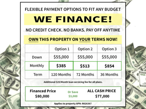
This week I’m only selling this lot for only $77,000!!!
And if you don’t have the money or credit, I’ll still finance the deal for you as well!
No Credit Check. No Banks. Pay Off Anytime.
Seller Finance Price of $80,000
Only $55,000 down payment
Click Here to View Due Diligence Report
Offers: Click Here to Submit Your Offer
Photos: Click Here to View Pictures
View Video Footage: Click Here to Watch Drone Video Footage
Inventory: Click Here To View All Available Properties
If you’re interested in the deal please call or text or email us at
Daisy Ramos 770-766-8919
land@q9properties.com
*Disclaimer – Buyers must perform the due diligence they should do with any land purchase. This land is sold as is and all information provided is to the best of the seller’s knowledge. Seller does not guarantee the accuracy of the property location on maps or descriptions shown in the listing as well as facts describing the property. Buyer to verify all details of the property including property location and boundaries and lot lines, as well as feasibility to use the property for buyer’s desired purpose. Many of the pictures provided are not personally taken by the seller and some of the presented pictures represent the general area near/around the property. All utilities related to this property are potentially subject to a connection charge or additional expense to bring them to or onto the property. Furthermore, It is understood and agreed to by the parties involved that the selling party, while holding an equitable interest in and to the property, is not presently making, and has not made, any representation to any party that it holds legal title in and to the property. To the fullest extent permitted by law, the Buyer hereby agrees to waive, release and forever discharge Q9 Property Solutions, Q9 Property Solutions, and all its affiliate companies from any claim, be it at law or in equity, that the Buyer, their heirs, transferees, assigns, subrogees, devisees, and agents may allege, arising out of our disclosure(s) of its present interest in and to the property, if any as well as out of any potential and accidental discrepancies in lot lines, pictures or property location to the actual property.
![cheap land for sale in [market_city] [state]](https://image-cdn.carrot.com/uploads/sites/54589/2016/03/selling-your-land.jpg)
